
Increased carrying capacity, range and time of flight open the new opportunities for drones in meteorology. The list of applications is almost endless: collecting information about temperature, humidity, pressure, speed and direction of wind, weather fronts, clouds, precipitations, gas composition and pollution, physical and chemical processes in atmosphere and ozone layer. For these tasks unmanned aerial system can be equipped with tele- and thermal vision or multispectral cameras, anemometers, barometers and other sensitive devices. Video and photo georeferenced data is being transmitted to the operator in real time by GPS channel. It is also possible to take samples on height smaller then flight range. All this data can be used for weather modeling and research of the lower layers of the atmosphere. Another one important application is the observation and modeling of the weather in airports and cosmodromes.
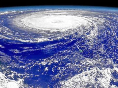
Thanks to increased power and remote control of SUAS close research of natural phenomena such as hurricane and tornado becomes possible. Another one promising way of use – weather control by seeding with silver iodide. SUAS use costs far less then manned airplanes. Aerial survey allows monitoring of glaciers, forests, water and ocean currents, especially with onboard thermal vision camera.
Thus, unmanned aerial systems provide new research methods for both applied and theoretical meteorology. Quickly collected data enables to increase the quality of weather modeling while cheapness, simplicity and mobility of the method open up new vistas for atmosphere research.